TrailDamage.com

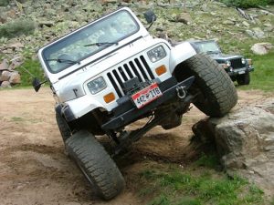
Photos, videos and information about 4x4 trails in Colorado and Utah

  • Trails
    • Colorado
    • Utah
  • Reports
    • Featured Photos
    • Featured Videos
    • Reports Calendar
  • Members
  • Search
  • Trail Damage Winners
  • FAQ
  • Community
  • Upcoming Events
  • Membership
  • Log In
  • Facebook
  • Instagram
  • RSS
  • Twitter
  • YouTube

Austin Corbin

July 30, 2004 by Austin Corbin

Austin C.

Join Date: July 31st, 2004
4x4 Vehicle: Khaki 2004 Jeep Wrangler Unlimited Rubicon
  • Modifications
  • Trails Conquered
  • Trails Led
No current or future vehicle modifications have been listed.
55 Different Trails Completed
Argentine Pass
Arths Pasture
Ballard Road
Bill Moore Lake
Bockman Road
Boreas Pass
Bull Canyon
Bull Mountain
Bull Mountain Road
Cascade Creek
Chinaman Gulch
3x
Coney Flats
2x
Deer Creek
Dry St. Vrain
Eagle Rock
Flat Iron Mesa
Four Arches Canyon
Gemini Bridges
Georgia Pass
Gillespie Gulch
Gould Mountain
Hell’s Revenge
Hohnholz Lakes
Hunkidori Mine
Liberty Trail
Lime Creek
Little Canyon
Long Canyon
McAllister Gulch
McClellan Mountain
Mendenhall
Michigan River
Middle St. Vrain
2x
Miller Rock
Monument Gulch
Mount Antero
Mount Princeton
North Sand Dunes Road
Oh-My-God Road
Old Flowers Road
Park Creek
Ptarmigan Pass
Red Cone
Red Elephant Hill
Saints John
Saran Wrap
Shrine Pass
Silver Creek
Spring Creek
3x
Swan River
Twin Cone
2x
West White Pine Mountain
Wheeler Lake
Yankee Hill
Yellow Cat Flat
0 Trails Completed as the Trail Leader
Join Us!
If you aren’t a Member or Subscriber, you can’t see all of the content on this site. Get membership information to see why this site is best when you join and log in

Information for Subscribers

When you log in you’ll see more information here:

  • Recent Community Forum posts
  • Recent polls
  • Upcoming Events you can attend
  • Links to online users

© 2000-2023 · TrailDamage.com · Terms and Conditions · About · Contact
Trail information is only accurate on the date posted. Trails may have changed or closed since that date. Use this information for historical purposes only.
Contact the Forest Service or Bureau of Land Management for up-to-date trail information.

/* ----------------------------------------- */ /* Content Template: Template for a Single Member - start */ /* ----------------------------------------- */ .entry-header { display:none; } .entry-content { margin-top:-12px; } .entry-title, .entry-meta { display:none; } .member-image { padding:2px; border:2px solid #ccc; margin-right:6px; } .user-gravatar { margin-right:4px; } #member-social { padding-top: 8px; width:100%; overflow: auto; } #trails-conquered-header { clear:both; } #trails-conquered-container { width:100%; } .trails-column { float:left; width:32%; } .trail-link { } .trail-multiple { display:inline; margin-left:4px; font-size:small: font-style:italic; } #tab_container_136422 { margin-top:40px; } /* ----------------------------------------- */ /* Content Template: Template for a Single Member - end */ /* ----------------------------------------- */