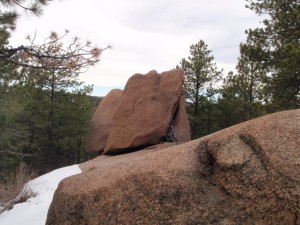
TrailDamage.com

Photos, videos and information about 4x4 trails in Colorado and Utah

  • Trails
    • Colorado
    • Utah
  • Reports
    • Featured Photos
    • Featured Videos
    • Reports Calendar
  • Members
  • Search
  • Trail Damage Winners
  • FAQ
  • Community
  • Upcoming Events
  • Membership
  • Log In
  • Facebook
  • Instagram
  • RSS
  • Twitter
  • YouTube

Balanced Rock Road 091024

October 24, 2009 by Mike Shannon

Balanced Rock Road

Trail Run on October 24, 2009
Report and photos by Mike S., Trail Leader
View trail information for Balanced Rock Road

Bob S.
Green 1997 Jeep Wrangler
Mike S.
Silver 2004 Jeep Wrangler Rubicon
Jeffrey M.
Khaki 2006 Jeep Wrangler Unlimited Rubicon
Bill S.
Yellow 2020 Jeep Wrangler Rubicon
Ryan S.
Red 1999 Jeep Wrangler
Roger R.
Gray 2021 Jeep Wrangler Rubicon 4xe
Walt S.
Gray 2022 Jeep Wrangler Unlimited Rubicon 392

After we were off of Mount Herman Road, we were quickly at Balanced Rock Road. The weather continued to be clear but cool. We turned down onto the trail and were having fun in 2-wheel drive in the snow. There was a burned-out trailer at the first clear area, so someone must have had a bad day!

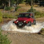
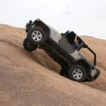
As we went down the trail, we passed one truck with deer hunters in it. Most of the traffic that we would see for the rest of the weekend would be deer hunters with only a few exceptions. As the trail got steeper and more rutted, most of us went into 4-wheel drive for added control during our descent. On one of the steepest descents, Mike, in the lead, started to slide off the trail. Attempts to drive out of it resulted in his Jeep sliding further towards the edge until he put it in 4-low and locked his differentials to get back onto the trail in reverse. Lockers became a nice-to-have for several of us at various times for the rest of the weekend.

We made it through the slippery switchback and were soon down to the parking area at the gate for the Palmer Lakes Reservoirs. After we walked around for a bit, it was time to see if we could climb back out. We headed up the trail and were pleasantly surprised to see that it was actually easier to go up the trail than it was going down. Roger remarked that it was because gravity is in control on the way down and we were in control on the way up. Well, control was a relative term as we were still slipping and sliding but as long as we were making headway we didn't feel like we could end up off into the trees!

At the end of the trail we were back on Rampart Range Road, and we decided on the spur of the moment to add Ice Cave Creek Road to the day's run. No one objected to getting a bonus trail in so we were off to run that trail next.

bill_on_the_trail
bob_on_the_trail_part_1
bob_on_the_trail_part_2
burned_out_trailer
jeffrey_on_the_trail
mike_at_the_end
parked_at_the_end_part_1
parked_at_the_end_part_2
roger_and_ryan
roger_on_the_trail
ryan_on_the_trail_part_1
ryan_on_the_trail_part_2
snowy_road_part_1
snowy_road_part_2
walt_on_the_trail

Reports from Other Days: 7

Use the arrows or dots to flip through the previews of the other reports for Balanced Rock Road. Click one of them to read more and see all of the photos from that day.

April 23, 2016

Led by Matt K.
After Mount Herman Road we went to Balanced Rock Road. There was snow at the start of the trail. It looked like some other people went down Balanced Rock Road before us. We didn’t hang out for long before making our way down Balanced Rock Road, too. We had fun…
« »
  • 1
  • 2
  • 3
  • 4
  • 5
  • 6
  • 7
Join Us!
If you aren’t a Member or Subscriber, you can’t see all of the content on this site. Get membership information to see why this site is best when you join and log in

Information for Subscribers

When you log in you’ll see more information here:

  • Recent Community Forum posts
  • Recent polls
  • Upcoming Events you can attend
  • Links to online users

© 2000-2022 · TrailDamage.com · Terms and Conditions · About · Contact
Trail information is only accurate on the date posted. Trails may have changed or closed since that date. Use this information for historical purposes only.
Contact the Forest Service or Bureau of Land Management for up-to-date trail information.

/* ----------------------------------------- */ /* View slug: reports-other-reports-for-same-trail-slider - start */ /* ----------------------------------------- */ /* place the prev/next controls on the sides */ .td-transition-controls .wpv-filter-next-link, .td-transition-controls .wpv-filter-previous-link { border: none; font-size: 300%; position: absolute; top: 70px; } .td-transition-controls .wpv-filter-previous-link { left: 0; } .td-transition-controls .wpv-filter-next-link { right: 0; } /* center the page selector horizonatally */ .td-transition-controls ul.wpv_pagination_dots { text-align: center; margin-top: 10px; } /* center the page selector horizonatally */ .td-transition-controls ul.wpv_pagination_dots li.wpv_pagination_dots_item, .td-transition-controls .wpv_pagination_dots li a { display: inline-block; float: none; } /* remove the default styles */ .td-transition-controls .wpv_pagination_dots li a { text-decoration: none; border-bottom: none; } .td-slider-container { padding: 0 25px; margin-bottom: 20px; position: relative; width:100%; display:table; } .td-slides { position: relative; } .td-slides-image { float:left; display:table-cell; } .td-slides-image img { border:1px solid #c0c0c0; } .td-slides-content { padding:4px 4px 4px 10px; border-top:1px solid #c0c0c0; border-right:1px solid #c0c0c0; border-bottom:1px solid #c0c0c0; display:table-cell; height:227px; overflow:hidden; } .td-slides-content h3 { margin-top:8px; } .td-slides-leader { font-size:smaller; margin-top:4px; } /* ----------------------------------------- */ /* View slug: reports-other-reports-for-same-trail-slider - end */ /* ----------------------------------------- */
/* ----------------------------------------- */ /* Content Template: Template for a Single Report - start */ /* ----------------------------------------- */ .entry-header { display:none; } .entry-content h1 { margin-top:16px; padding-top:0; } h1 a { color:#222; } h1 a:hover { color:#666; } p.entry-meta { font-size:small; } #report-body-spacer { clear:both; width:100%; height:20px; } #addtoany-bar { margin-bottom:2em; text-align:center; } .category-reports .post-info .author, .post-info .date { display: none; } .addthis_recommended_horizontal { text-align:center !important; } /* ----------------------------------------- */ /* Content Template: Template for a Single Report - end */ /* ----------------------------------------- */ /* ----------------------------------------- */ /* Content Template: Loop item in REPORTS Runners - start */ /* ----------------------------------------- */ #runners-container { width:100%; clear:both; } .runner { border:1px solid #c0c0c0; margin:0 6px 6px 0; float:left; width:49%; height:81px; } .runner-image { float: left; } .runner-image img { margin:2px 10px 0 2px; height:75px; width:75px; } .runner-name { text-transform:uppercase; } .runner-name a { color:#222; } .runner-name a:hover { color:#666; } .runner-vehicle { font-size:small; } @media only screen and (max-width: 768px) { .runner { width:100%; } } /* ----------------------------------------- */ /* Content Template: Loop item in REPORTS Runners - end */ /* ----------------------------------------- */