TrailDamage.com

Photos, videos and information about 4x4 trails in Colorado and Utah

  • Trails
    • Colorado
    • Utah
  • Reports
    • Featured Photos
    • Featured Videos
    • Reports Calendar
  • Members
  • Search
  • Trail Damage Winners
  • FAQ
  • Community
  • Upcoming Events
  • Membership
  • Log In
  • Facebook
  • Instagram
  • RSS
  • Twitter
  • YouTube

Flat Iron Mesa 080412

April 12, 2008 by Mike Shannon

Flat Iron Mesa

Trail Run on April 12, 2008
Report and photos by Mike S., Trail Leader
View trail information for Flat Iron Mesa

Walt S.
Gray 2018 Jeep Wrangler Unlimited Rubicon
Roger R.
White 2005 Jeep Wrangler Unlimited Rubicon
Mike S.
Silver 2004 Jeep Wrangler Rubicon

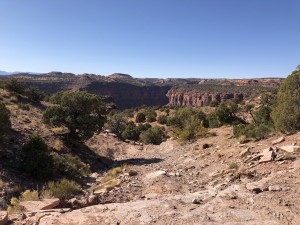
Flat Iron Mesa would be the last trail of this run to Moab for us, and with that in mind we were determined to get as much enjoyment out of it as we could. We aired down next to Highway 191 and were soon on the trail. The air was clear and the sun was out, making for some incredible views of the La Sal mountains with their fresh snow covering.

We stopped at the top of Rubble Hill to share the view with some cattle. Then we moved on to the red slickrock that looks like brick pavers. Somewhere after this we got off the normal track but we were still following a well-established trail. This route had some interesting climbs and descents and was interesting although not quite as challenging as the more established route.

We were soon back on the main route and were quickly at Tilt-a-Whirl. In fact, we were there so quickly that we didn't notice that we had taken the bypass until we were at the bottom of Tilt-a-Whirl. We opted to go on down the chute with the edge drop-offs. It wasn't long before we were stopped at the Hatch Wash overlook for lunch.

When we got to Easter Egg Hill, we all opted to take the bypass rather than to push our luck so late in the week, because this was our last day before heading back to Denver. That turned out to be a good decision, at least for Mike, as it was right after this that his rear driveshaft fell out onto the trail while he was driving through an easy section. The bolts all backed out of the transfer case output shaft at the same time, all falling on the trail either right behind or under the Jeep. The back of the driveshaft also fell out as the force broke one of the retaining bolts at the pinion end.

We determined there was no other damage, picked the parts up, and Mike drove out in four-wheel high. Luckily the trail was easy from that point on. A quick stop at the Moab Outpost to extract the broken bolt and to reinstall the driveshaft got Mike back in business. After five days and many miles of trails, we all felt fortunate that this was the only damage sustained and it was easily repaired.

airing_down_part_1
airing_down_part_2
hatch_wash_part_1
hatch_wash_part_2
jeeps_and_the_la_sal_mountains
mike_trail_damage_part_1
mike_trail_damage_part_2
roger_down_a_ledge
roger_on_rocks_part_1
roger_on_rocks_part_2
roger_up_an_early_ledge
roger_up_rubble_hill
walt_on_the_trail

Reports from Other Days: 5

Use the arrows or dots to flip through the previews of the other reports for Flat Iron Mesa. Click one of them to read more and see all of the photos from that day.

October 19, 2019

Led by Matt K.
Flat Iron Mesa was our first trail for Moab in the Fall of 2019. Matt had been wanting to run Flat Iron Mesa for some time, and now his time had finally come! We started at the north end of Flat Iron Mesa and aired down in the parking area…
»
  • 1
  • 2
  • 3
  • 4
  • 5
Join Us!
If you aren’t a Member or Subscriber, you can’t see all of the content on this site. Get membership information to see why this site is best when you join and log in

Information for Subscribers

When you log in you’ll see more information here:

  • Recent Community Forum posts
  • Recent polls
  • Upcoming Events you can attend
  • Links to online users

© 2000-2021 · TrailDamage.com · Terms and Conditions · About · Contact
Trail information is only accurate on the date posted. Trails may have changed or closed since that date. Use this information for historical purposes only.
Contact the Forest Service or Bureau of Land Management for up-to-date trail information.

/* ----------------------------------------- */ /* View slug: reports-other-reports-for-same-trail-slider - start */ /* ----------------------------------------- */ /* place the prev/next controls on the sides */ .td-transition-controls .wpv-filter-next-link, .td-transition-controls .wpv-filter-previous-link { border: none; font-size: 300%; position: absolute; top: 70px; } .td-transition-controls .wpv-filter-previous-link { left: 0; } .td-transition-controls .wpv-filter-next-link { right: 0; } /* center the page selector horizonatally */ .td-transition-controls ul.wpv_pagination_dots { text-align: center; margin-top: 10px; } /* center the page selector horizonatally */ .td-transition-controls ul.wpv_pagination_dots li.wpv_pagination_dots_item, .td-transition-controls .wpv_pagination_dots li a { display: inline-block; float: none; } /* remove the default styles */ .td-transition-controls .wpv_pagination_dots li a { text-decoration: none; border-bottom: none; } .td-slider-container { padding: 0 25px; margin-bottom: 20px; position: relative; width:100%; display:table; } .td-slides { position: relative; } .td-slides-image { float:left; display:table-cell; } .td-slides-image img { border:1px solid #c0c0c0; } .td-slides-content { padding:4px 4px 4px 10px; border-top:1px solid #c0c0c0; border-right:1px solid #c0c0c0; border-bottom:1px solid #c0c0c0; display:table-cell; height:227px; overflow:hidden; } .td-slides-content h3 { margin-top:8px; } .td-slides-leader { font-size:smaller; margin-top:4px; } /* ----------------------------------------- */ /* View slug: reports-other-reports-for-same-trail-slider - end */ /* ----------------------------------------- */
/* ----------------------------------------- */ /* Content Template: Template for a Single Report - start */ /* ----------------------------------------- */ .entry-header { display:none; } .entry-content h1 { margin-top:16px; padding-top:0; } h1 a { color:#222; } h1 a:hover { color:#666; } p.entry-meta { font-size:small; } #report-body-spacer { clear:both; width:100%; height:20px; } #addtoany-bar { margin-bottom:2em; text-align:center; } .category-reports .post-info .author, .post-info .date { display: none; } .addthis_recommended_horizontal { text-align:center !important; } /* ----------------------------------------- */ /* Content Template: Template for a Single Report - end */ /* ----------------------------------------- */ /* ----------------------------------------- */ /* Content Template: Loop item in REPORTS Runners - start */ /* ----------------------------------------- */ #runners-container { width:100%; clear:both; } .runner { border:1px solid #c0c0c0; margin:0 6px 6px 0; float:left; width:49%; height:81px; } .runner-image { float: left; } .runner-image img { margin:2px 10px 0 2px; height:75px; width:75px; } .runner-name { text-transform:uppercase; } .runner-name a { color:#222; } .runner-name a:hover { color:#666; } .runner-vehicle { font-size:small; } @media only screen and (max-width: 768px) { .runner { width:100%; } } /* ----------------------------------------- */ /* Content Template: Loop item in REPORTS Runners - end */ /* ----------------------------------------- */