TrailDamage.com

Photos, videos and information about 4x4 trails in Colorado and Utah

  • Trails
    • Colorado
    • Utah
  • Reports
    • Featured Photos
    • Featured Videos
    • Reports Calendar
  • Members
  • Search
  • Trail Damage Winners
  • FAQ
  • Community
  • Upcoming Events
  • Membership
  • Log In
  • Facebook
  • Instagram
  • RSS
  • Twitter
  • YouTube

Wager Gulch 090825

August 25, 2009 by Monica

Wager Gulch

Trail Run on August 25, 2009
Report and photos by Monica I., Trail Leader
View trail information for Wager Gulch

Gary R.
Yellow 1978 Jeep CJ-7
Dave E.
Blue 1999 Jeep Cherokee
Mike S.
Silver 2004 Jeep Wrangler Rubicon
Walt S.
Gray 2022 Jeep Wrangler Unlimited Rubicon 392
Monica I.
Red 2010 Jeep Wrangler Rubicon
Bob R.
Green 2003 Jeep Wrangler Rubicon

We were barely into the Cinnamon Pass trail when we found the trailhead for Wager Gulch, so we headed up that trail. It started by weaving its way through a residential area, but soon we were on a trail climbing through trees.

And wow, did it climb! This is one of the most continuously steep trails we've been on, and the climb continued for quite awhile. We were almost always surrounded by trees on both sides, and though the trail could be loose at times it was never difficult. If it was wet, though, that would change everything. We weren't sure it would be passable in mud.

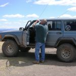
When we came to the first open and flat area, we stopped to get out and stretch our legs. We were by an old cabin and the views were gorgeous. We were treated to warm sunshine though it was still a bit chilly. We visited for quite awhile before getting back in our Jeeps and continuing on.

We didn't go far before turning down on a spur to go see the Carson ghost town. There was lots of easy parking, and everyone got out to explore. The buildings were well-preserved, making it easier to imagine what it would have been like to live there. Apparently, the town used to be huge, stretching up to the Continental Divide that we could see above us. It must have really been a sight.

We could see a vehicle far above us on the trail that seemed to be parked. Another one was on its way down so we waited until it passed. Once it was past us we headed up.

The trail above Carson is fun, with a few bumpy sections and trail that weaves in and around low brush. We were far above timberline, allowing us to really see everything around us. We passed the parked vehicle and were soon at the top and at the Continental Divide, enjoying the amazing views of the valley and Carson below us.

Just over the Divide is a parking area and intersection of many trails. Some trails are closed while others are not accessible by vehicle. Mike told us about when he and Roger went up and over a trail we could see contining on, and luckily we had that trail planned for the next day. We knew we'd be back, so we skipped that spur.

A few of us went to the end of the trail, noted the non-4x4 trail continuing on, and then turned around and headed back to the others at the crossroads. The views were gorgeous, but we had a lot to do before the day was over so we headed back down.

We didn't see anyone else on the way down, which was good. It's amazing how quickly a steep downhill trail will go by when you're on your way out. We were soon back at the trailhead and we turned left to continue along the Cinnamon Pass trail.

approaching_carson
aspens
between_trees
blue_sky
bob_on_the_trail
bumpy_trail
bumpy
carson_barn
carson_in_blue_skies
carson_in_the_trees
creek_by_carson
creek
dave_at_the_end
dave_on_the_trail
doorway_in_carson
early_climb
gary_on_the_trail
inside_an_old_barn
lost_trail_creek
mike_on_the_trail
mining_near_carson
monica_making_progress
monica_on_the_trail
near_the_end
old_cabin
parked_at_carson
parked_in_scenery
puddle
start_of_the_trail
through_aspens
to_the_continental_divide
trail_behind_us
trail_out_of_the_gulch
trailhead_signs
view_from_carson
view_from_the_end
walt_on_the_trail
well-preserved_carson_buildings
Join Us!
If you aren’t a Member or Subscriber, you can’t see all of the content on this site. Get membership information to see why this site is best when you join and log in

Information for Subscribers

When you log in you’ll see more information here:

  • Recent Community Forum posts
  • Recent polls
  • Upcoming Events you can attend
  • Links to online users

© 2000-2022 · TrailDamage.com · Terms and Conditions · About · Contact
Trail information is only accurate on the date posted. Trails may have changed or closed since that date. Use this information for historical purposes only.
Contact the Forest Service or Bureau of Land Management for up-to-date trail information.

/* ----------------------------------------- */ /* View slug: reports-other-reports-for-same-trail-slider - start */ /* ----------------------------------------- */ /* place the prev/next controls on the sides */ .td-transition-controls .wpv-filter-next-link, .td-transition-controls .wpv-filter-previous-link { border: none; font-size: 300%; position: absolute; top: 70px; } .td-transition-controls .wpv-filter-previous-link { left: 0; } .td-transition-controls .wpv-filter-next-link { right: 0; } /* center the page selector horizonatally */ .td-transition-controls ul.wpv_pagination_dots { text-align: center; margin-top: 10px; } /* center the page selector horizonatally */ .td-transition-controls ul.wpv_pagination_dots li.wpv_pagination_dots_item, .td-transition-controls .wpv_pagination_dots li a { display: inline-block; float: none; } /* remove the default styles */ .td-transition-controls .wpv_pagination_dots li a { text-decoration: none; border-bottom: none; } .td-slider-container { padding: 0 25px; margin-bottom: 20px; position: relative; width:100%; display:table; } .td-slides { position: relative; } .td-slides-image { float:left; display:table-cell; } .td-slides-image img { border:1px solid #c0c0c0; } .td-slides-content { padding:4px 4px 4px 10px; border-top:1px solid #c0c0c0; border-right:1px solid #c0c0c0; border-bottom:1px solid #c0c0c0; display:table-cell; height:227px; overflow:hidden; } .td-slides-content h3 { margin-top:8px; } .td-slides-leader { font-size:smaller; margin-top:4px; } /* ----------------------------------------- */ /* View slug: reports-other-reports-for-same-trail-slider - end */ /* ----------------------------------------- */
/* ----------------------------------------- */ /* Content Template: Template for a Single Report - start */ /* ----------------------------------------- */ .entry-header { display:none; } .entry-content h1 { margin-top:16px; padding-top:0; } h1 a { color:#222; } h1 a:hover { color:#666; } p.entry-meta { font-size:small; } #report-body-spacer { clear:both; width:100%; height:20px; } #addtoany-bar { margin-bottom:2em; text-align:center; } .category-reports .post-info .author, .post-info .date { display: none; } .addthis_recommended_horizontal { text-align:center !important; } /* ----------------------------------------- */ /* Content Template: Template for a Single Report - end */ /* ----------------------------------------- */ /* ----------------------------------------- */ /* Content Template: Loop item in REPORTS Runners - start */ /* ----------------------------------------- */ #runners-container { width:100%; clear:both; } .runner { border:1px solid #c0c0c0; margin:0 6px 6px 0; float:left; width:49%; height:81px; } .runner-image { float: left; } .runner-image img { margin:2px 10px 0 2px; height:75px; width:75px; } .runner-name { text-transform:uppercase; } .runner-name a { color:#222; } .runner-name a:hover { color:#666; } .runner-vehicle { font-size:small; } @media only screen and (max-width: 768px) { .runner { width:100%; } } /* ----------------------------------------- */ /* Content Template: Loop item in REPORTS Runners - end */ /* ----------------------------------------- */