TrailDamage.com

Photos, videos and information about 4x4 trails in Colorado and Utah

  • Trails
    • Colorado
    • Utah
  • Reports
    • Featured Photos
    • Featured Videos
    • Reports Calendar
  • Members
  • Search
  • Trail Damage Winners
  • FAQ
  • Community
  • Upcoming Events
  • Membership
  • Log In
  • Facebook
  • Instagram
  • RSS
  • Twitter
  • YouTube

Polar Mesa 120518

May 18, 2012 by Monica

Polar Mesa

Trail Run on May 18, 2012
Report and photos by Monica I., Trail Leader
View trail information for Polar Mesa

Julie M.
Green 2012 Jeep Wrangler Unlimited Rubicon
Matt K.
White 2016 Jeep Wrangler Unlimited Rubicon
Eric S.
Yellow 2004 Nissan Xterra
Monica I.
Red 2010 Jeep Wrangler Rubicon
Mike S.
Silver 2004 Jeep Wrangler Rubicon
Walt S.
Gray 2022 Jeep Wrangler Unlimited Rubicon 392

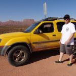
We wrapped up Thompson Canyon and turned to do Polar Mesa, another new trail for the group. It looked like it would also be an easy and mellow trail. The start was fairly straight as it worked its way along a wide and easy dirt road.

It was a sudden change to be climbing switchbacks. The views of the trail below us were really nice as we climbed. This part of Polar Mesa wasn't part of the Kokopelli Trail so we didn't see any bicycles. We didn't see anyone, in fact.

It was a very easy road to the top, and when we got to the mining area we stopped near the big tower and got out to stretch our legs. It looked like the trail continued there but it was not graded or well used. We checked out some maps and it looked like we could make a loop out of the top of the trail. We planned on coming back to that spot after checking out the end of the trail.

The end of the trail wasn't far from there and we were soon parking at the overlook. We explored the area for a while. There were closed mine shafts, leftovers from mine car tracks, and metal structures used during the mine's days. The views were nice, and it was worth the walk down to the mine.

We got back in our rigs and went back to the mine where we had stopped earlier. This time we kept going, following the most-used tracks. It was narrower and not maintained, and some sections were a bit rocky. It was completely different than the rest of the trail.

You could do a lot of exploring in that network of trails, but we chose to find a good loop. We had to weave through cows at one point, but it was pretty easy to find the main trail again. That put us at the top of the switchbacks.

We went down the switchbacks and out the easy trail to the end of Gateway Road. When the dirt changed to pavement at the end of the Gateway Road trail we stopped at the pull-out to air up. We also checked out the big views from there and went to look for dinosaur footprints in the rock. We found a few, and it was a good time.

Even though our day didn't go as planned we still had a nice time. We got out of the heat and into the mountains where it was cool (and sometimes chilly). That also put us back in Moab in time for a good dinner together. It was a great day.

airing_up
big_trees
big_view
bumpy_spot
climbing
clouds
cows
desert
dinosaur_track_1
dinosaur_track_2
easy_near_the_start
eric_trail_damage
exploring_at_the_overlook
flat_spot
forest_service_sign
happy_boys
into_the_sky
julie_in_scenery
la_sal_mountains
layers
little-used_trail
look
looking_for_dinosaur_tracks
mellow_trail
mine_shaft
mine
mining_equipment_part_1
mining_equipment_part_2
monica_on_the_trail
old_tunnel
parked_at_the_mine
parked_at_the_overlook
rails
snowy_peaks
switchbacks
through_the_brush
trail_below
valley_near_gateway_road
view_from_the_overlook_part_1
view_from_the_overlook_part_2
view_from_the_overlook_part_3
view_from_the_overlook_part_4
view_off_of_gateway_road
walt_and_julie
walt_in_the_lineup
Join Us!
If you aren’t a Member or Subscriber, you can’t see all of the content on this site. Get membership information to see why this site is best when you join and log in

Information for Subscribers

When you log in you’ll see more information here:

  • Recent Community Forum posts
  • Recent polls
  • Upcoming Events you can attend
  • Links to online users

© 2000-2022 · TrailDamage.com · Terms and Conditions · About · Contact
Trail information is only accurate on the date posted. Trails may have changed or closed since that date. Use this information for historical purposes only.
Contact the Forest Service or Bureau of Land Management for up-to-date trail information.

/* ----------------------------------------- */ /* View slug: reports-other-reports-for-same-trail-slider - start */ /* ----------------------------------------- */ /* place the prev/next controls on the sides */ .td-transition-controls .wpv-filter-next-link, .td-transition-controls .wpv-filter-previous-link { border: none; font-size: 300%; position: absolute; top: 70px; } .td-transition-controls .wpv-filter-previous-link { left: 0; } .td-transition-controls .wpv-filter-next-link { right: 0; } /* center the page selector horizonatally */ .td-transition-controls ul.wpv_pagination_dots { text-align: center; margin-top: 10px; } /* center the page selector horizonatally */ .td-transition-controls ul.wpv_pagination_dots li.wpv_pagination_dots_item, .td-transition-controls .wpv_pagination_dots li a { display: inline-block; float: none; } /* remove the default styles */ .td-transition-controls .wpv_pagination_dots li a { text-decoration: none; border-bottom: none; } .td-slider-container { padding: 0 25px; margin-bottom: 20px; position: relative; width:100%; display:table; } .td-slides { position: relative; } .td-slides-image { float:left; display:table-cell; } .td-slides-image img { border:1px solid #c0c0c0; } .td-slides-content { padding:4px 4px 4px 10px; border-top:1px solid #c0c0c0; border-right:1px solid #c0c0c0; border-bottom:1px solid #c0c0c0; display:table-cell; height:227px; overflow:hidden; } .td-slides-content h3 { margin-top:8px; } .td-slides-leader { font-size:smaller; margin-top:4px; } /* ----------------------------------------- */ /* View slug: reports-other-reports-for-same-trail-slider - end */ /* ----------------------------------------- */
/* ----------------------------------------- */ /* Content Template: Template for a Single Report - start */ /* ----------------------------------------- */ .entry-header { display:none; } .entry-content h1 { margin-top:16px; padding-top:0; } h1 a { color:#222; } h1 a:hover { color:#666; } p.entry-meta { font-size:small; } #report-body-spacer { clear:both; width:100%; height:20px; } #addtoany-bar { margin-bottom:2em; text-align:center; } .category-reports .post-info .author, .post-info .date { display: none; } .addthis_recommended_horizontal { text-align:center !important; } /* ----------------------------------------- */ /* Content Template: Template for a Single Report - end */ /* ----------------------------------------- */ /* ----------------------------------------- */ /* Content Template: Loop item in REPORTS Runners - start */ /* ----------------------------------------- */ #runners-container { width:100%; clear:both; } .runner { border:1px solid #c0c0c0; margin:0 6px 6px 0; float:left; width:49%; height:81px; } .runner-image { float: left; } .runner-image img { margin:2px 10px 0 2px; height:75px; width:75px; } .runner-name { text-transform:uppercase; } .runner-name a { color:#222; } .runner-name a:hover { color:#666; } .runner-vehicle { font-size:small; } @media only screen and (max-width: 768px) { .runner { width:100%; } } /* ----------------------------------------- */ /* Content Template: Loop item in REPORTS Runners - end */ /* ----------------------------------------- */