TrailDamage.com

Photos, videos and information about 4x4 trails in Colorado and Utah

  • Trails
    • Colorado
    • Utah
  • Reports
    • Featured Photos
    • Featured Videos
    • Reports Calendar
  • Members
  • Search
  • Trail Damage Winners
  • FAQ
  • Community
  • Upcoming Events
  • Membership
  • Log In
  • Facebook
  • Instagram
  • RSS
  • Twitter
  • YouTube

Mount Bross 070811

August 11, 2007 by Monica

Mount Bross

Trail Run on August 11, 2007
Report and photos by Monica I., Trail Leader
View trail information for Mount Bross

Brian D.
Brown 1978 International Scout II
Gary R.
Yellow 1978 Jeep CJ-7
Walt S.
Gray 2018 Jeep Wrangler Unlimited Rubicon
Bill S.
Khaki 2004 Jeep Wrangler Rubicon
Matt K.
White 2016 Jeep Wrangler Unlimited Rubicon
Michael M.
Black 2006 Jeep Wrangler Unlimited Rubicon
Todd S.
Silver 2005 Jeep Wrangler Unlimited Rubicon
Mike V.
Blue 2000 Jeep Cherokee
Mark F.
Blue 2002 Jeep Wrangler
Ladd G.
Green 2003 Jeep Wrangler Rubicon
Don W.
Silver 2005 Jeep Wrangler Rubicon
Mike S.
Silver 2004 Jeep Wrangler Rubicon
Mike C.
Red 2012 Jeep Wrangler Unlimited Rubicon
Steve B.
Green 2000 Jeep Wrangler
Dave B.
Black 2004 Jeep Wrangler Rubicon

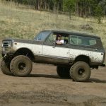
We had a big, happy group for this run. Everyone hoped for a day of big scenery, starting with this trail to the top of Mount Bross. It ended up being a great trip and a great trail, and one of our most scenic lunch spots.

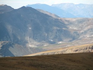
We aired down on Buckskin Road, then went a bit further to turn on Windy Ridge Road to go up to Mount Bross. We climbed up the easy trail, and we soon had a great view of Alma and the valley below us. The weather was perfect, with blue skies and warm weather.

We got to the lower intersection very quickly, and decided to go up to the Windy Ridge parking area and take the northern half of the loop first. We all managed to fit in the parking area, and everyone got out for a bit to stretch their legs and visit. We were at timberline, and we could see the trail going up the side of Mount Bross before us.

We hopped in our vehicles and headed up the trail. We saw a few marmots on the way, and the scenery around us was impressive. There were a few mining buildings, but the most complete one was at the Dolly Varden Mine.

When we came around the corner near the top we saw Mount Lincoln and Mount Cameron, and the views took our breaths away. There were hikers all over both mountains, in addition to the many hikers on Mount Bross. We stopped at the first big, flat area to take a look around and enjoy the views, but then we headed up.

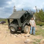
The top of Mount Bross was very flat and huge. It looked much bigger than a football field. We parked in a group and many of us walked out to the edges, but they were pretty far away.

It wasn't very windy for some odd reason, so we set up for lunch. We made a big circle in the middle of the Jeeps, just in case it did get windy. It seemed odd to be on top of a 14er without any wind.

The sun was on us as we ate, and everyone was happy. Everyone was also getting sunburned, it seemed. We do find the best lunch spots.

Everyone seemed reluctant to leave, but eventually we packed up and headed down. We took the other side of the loop, and it was a gorgeous decent on that side. We saw a deer on the mountainside and everyone snapped pictures.

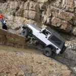
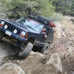
The only bad part was an extremely tight and tippy switchback. We could have gone a different way, but everyone decided to tackle the switchback. It took us a little while, but everyone was careful and there were no incidents. When we were all through it, we continued on.

The last switchbacks to the lower intersection were rocky, but no one had any issues. We were soon down and on our way back out.

We took the quick trip to Kite Lake, just to check it out. It was packed with people, and they watched our big group as we drove to the lake and around a circle and then back out. It was pretty and very, very crowded. Cars were parked everywhere, too.

We headed back to Alma to go over to Mosquito Pass. It was a great start to our day!

above_timberline
airing_down
alma_part_1
alma_part_2
around_a_bend
bill_on_the_trail
blue_sky
bristlecone_pine
by_a_mining_building
cabin_near_lower_intersection
climbing
creek_crossing_near_kite_lake
crossroads_with_mount_lincoln_part_1
crossroads_with_mount_lincoln_part_2
crossroads_with_mount_lincoln_part_3
dane_on_the_trail
deer_part_1
deer_part_2
descent
down_from_mount_bross_part_1
down_from_mount_bross_part_2
early_trail
everyone_down_the_mountain
final_trail_to_the_top_part_1
final_trail_to_the_top_part_2
gary_on_the_trail
high_switchback
jeeps_after_windy_ridge_part_1
jeeps_after_windy_ridge_part_2
jeeps_climbing
just_past_windy_ridge
kite_lake_part_1
kite_lake_part_2
kite_lake_part_3
kite_lake_part_4
ladd_on_the_trail
mark_on_the_trail
marmot
mike_s_and_dane
mine_shaft
mining_structure
mount_cameron_part_1
mount_cameron_part_2
mount_lincoln_part_1
mount_lincoln_part_2
mount_lincoln_part_3
near_lower_intersection
parked_at_windy_ridge
shelf_road
sign_for_857
sign
south_park_part_1
south_park_part_2
start_of_the_trail
structure_near_lower_intersection_part_1
structure_near_lower_intersection_part_2
to_kite_lake_part_1
to_kite_lake_part_2
to_the_top
top_of_mount_bross_part_1
top_of_mount_bross_part_2
top_of_mount_bross_part_3
top_of_mount_bross_part_4
top_of_mount_bross_part_5
trailhead_sign
view_at_windy_ridge_part_1
view_at_windy_ridge_part_2
view_near_the_lower_intersection
view_near_the_start
view_of_the_valley
view_to_the_north
walt_on_the_trail
wildflowers
windy_ridge_sign
windy_ridge_trail_part_1
windy_ridge_trail_part_2
windy_ridge

Report from a Different Day

September 3, 2005

Led by Mark F.
We left the Conifer meeting location at about 8:20AM and proceeded to the turnoff for Kite Lake in Alma. The turnoff for Mount Bross is about 2 1/2 miles up this road. Another 2 1/2 miles of dried-up mud puddles and one ascending section with 3 or 4 moguls brought…
Join Us!
If you aren’t a Member or Subscriber, you can’t see all of the content on this site. Get membership information to see why this site is best when you join and log in

Information for Subscribers

When you log in you’ll see more information here:

  • Recent Community Forum posts
  • Recent polls
  • Upcoming Events you can attend
  • Links to online users

© 2000-2021 · TrailDamage.com · Terms and Conditions · About · Contact
Trail information is only accurate on the date posted. Trails may have changed or closed since that date. Use this information for historical purposes only.
Contact the Forest Service or Bureau of Land Management for up-to-date trail information.

/* ----------------------------------------- */ /* View slug: reports-other-reports-for-same-trail-slider - start */ /* ----------------------------------------- */ /* place the prev/next controls on the sides */ .td-transition-controls .wpv-filter-next-link, .td-transition-controls .wpv-filter-previous-link { border: none; font-size: 300%; position: absolute; top: 70px; } .td-transition-controls .wpv-filter-previous-link { left: 0; } .td-transition-controls .wpv-filter-next-link { right: 0; } /* center the page selector horizonatally */ .td-transition-controls ul.wpv_pagination_dots { text-align: center; margin-top: 10px; } /* center the page selector horizonatally */ .td-transition-controls ul.wpv_pagination_dots li.wpv_pagination_dots_item, .td-transition-controls .wpv_pagination_dots li a { display: inline-block; float: none; } /* remove the default styles */ .td-transition-controls .wpv_pagination_dots li a { text-decoration: none; border-bottom: none; } .td-slider-container { padding: 0 25px; margin-bottom: 20px; position: relative; width:100%; display:table; } .td-slides { position: relative; } .td-slides-image { float:left; display:table-cell; } .td-slides-image img { border:1px solid #c0c0c0; } .td-slides-content { padding:4px 4px 4px 10px; border-top:1px solid #c0c0c0; border-right:1px solid #c0c0c0; border-bottom:1px solid #c0c0c0; display:table-cell; height:227px; overflow:hidden; } .td-slides-content h3 { margin-top:8px; } .td-slides-leader { font-size:smaller; margin-top:4px; } /* ----------------------------------------- */ /* View slug: reports-other-reports-for-same-trail-slider - end */ /* ----------------------------------------- */
/* ----------------------------------------- */ /* Content Template: Template for a Single Report - start */ /* ----------------------------------------- */ .entry-header { display:none; } .entry-content h1 { margin-top:16px; padding-top:0; } h1 a { color:#222; } h1 a:hover { color:#666; } p.entry-meta { font-size:small; } #report-body-spacer { clear:both; width:100%; height:20px; } #addtoany-bar { margin-bottom:2em; text-align:center; } .category-reports .post-info .author, .post-info .date { display: none; } .addthis_recommended_horizontal { text-align:center !important; } /* ----------------------------------------- */ /* Content Template: Template for a Single Report - end */ /* ----------------------------------------- */ /* ----------------------------------------- */ /* Content Template: Loop item in REPORTS Runners - start */ /* ----------------------------------------- */ #runners-container { width:100%; clear:both; } .runner { border:1px solid #c0c0c0; margin:0 6px 6px 0; float:left; width:49%; height:81px; } .runner-image { float: left; } .runner-image img { margin:2px 10px 0 2px; height:75px; width:75px; } .runner-name { text-transform:uppercase; } .runner-name a { color:#222; } .runner-name a:hover { color:#666; } .runner-vehicle { font-size:small; } @media only screen and (max-width: 768px) { .runner { width:100%; } } /* ----------------------------------------- */ /* Content Template: Loop item in REPORTS Runners - end */ /* ----------------------------------------- */