TrailDamage.com

Photos, videos and information about 4x4 trails in Colorado and Utah

  • Trails
    • Colorado
    • Utah
  • Reports
    • Featured Photos
    • Featured Videos
    • Reports Calendar
  • Members
  • Search
  • Trail Damage Winners
  • FAQ
  • Community
  • Upcoming Events
  • Membership
  • Log In
  • Facebook
  • Instagram
  • RSS
  • Twitter
  • YouTube

Hackett Gulch 091025

October 25, 2009 by Mike Shannon

Hackett Gulch

Trail Run on October 25, 2009
Report and photos by Mike S., Trail Leader
View trail information for Hackett Gulch

Roger R.
Gray 2021 Jeep Wrangler Rubicon 4xe
Mike S.
Silver 2004 Jeep Wrangler Rubicon
Walt S.
Gray 2022 Jeep Wrangler Unlimited Rubicon 392

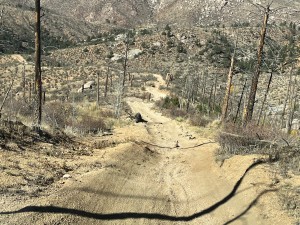
Hackett Gulch was the third and final trail for us this weekend. It was getting late in the afternoon when we reached the trailhead and it was beginning to snow in earnest. We stopped to read the signs proclaiming Hackett Gulch to be "Rated Most Difficult." This, in conjunction with the accumulated and freshly falling snow caused a little concern, but we knew we could always turn around if we encountered anything we felt was too dangerous or that might trap us on the trail. With the forecast for deteriorating conditions, we did not want to spend the night on the trail!

Unlike Metberry Gulch and Longwater Gulch, Hackett Gulch starts with some descents following the contours of the gulch that contains the trail. While steep and somewhat off-camber, these presented no problem. We were soon at a short but steep climb. The trail splits around a tree with the right side of the trail having a deep wash down the center. We opted for the left side and were soon at the base of Hackett Rock. We all went up the right side of this with little trouble except for Mike, in the lead, making a couple tries before finding the right line with some spotting provided over the radio. With the snow, no one really wanted to get out, so we didn't spot each other and, unfortunately, we also didn't get any pictures.

After Hackett Rock, the trail climbs and descends with one more rock slab climb to navigate. While there is a winch point provided above the slab, no one needed it. The descents to the end of the trail at the Park County line were a little challenging but we all had no problem with traction even through there were some moguls in some sections.

After a brief stop at the end of the trail, we turned around and headed back out. At the bottom of Hackett Rock, Mike opted to go down the washed out section of the trail and had one brief scare when the driver's side of his Jeep dropped into the crack. The ground was awfully close to his driver's window but he didn't flop. He managed to drive out of the crack without further incident. Walt followed Mike without the drama, and Roger opted for the other side of the tree.

We were soon back at the trailhead. With the weather now rapidly getting worse, we decided to call it a weekend. We went north on Cedar Mountain Road and aired up at the fire station in Westcreek. We parted ways at Deckers with Roger and Walt going home through Pine Junction and Mike heading off via Sedalia. The trip past the end of Rampart Range Road ending up being the most stressful part of the day with it snowing so hard visibility was down to about ten feet.

early_trail_part_1
early_trail_part_2
out_of_reach
parked_at_the_end
rock_slab
second_obstacle
signs_at_the_start_part_1
signs_at_the_start_part_2
trail_closed_sign_1
trail_closed_sign_2
walt_parked_at_the_end

Reports from Other Days: 4

Use the arrows or dots to flip through the previews of the other reports for Hackett Gulch. Click one of them to read more and see all of the photos from that day.

October 16, 2021

Led by Matt K.
We met up in Woodland Park and then drove out to the Gulches. We aired down in the parking area on Cedar Mountain Road and then we started down the trail. It looked like it was going to be a very nice day. It was sunny and warm with no…
»
  • 1
  • 2
  • 3
  • 4
Join Us!
If you aren’t a Member or Subscriber, you can’t see all of the content on this site. Get membership information to see why this site is best when you join and log in

Information for Subscribers

When you log in you’ll see more information here:

  • Recent Community Forum posts
  • Recent polls
  • Upcoming Events you can attend
  • Links to online users

© 2000-2022 · TrailDamage.com · Terms and Conditions · About · Contact
Trail information is only accurate on the date posted. Trails may have changed or closed since that date. Use this information for historical purposes only.
Contact the Forest Service or Bureau of Land Management for up-to-date trail information.

/* ----------------------------------------- */ /* View slug: reports-other-reports-for-same-trail-slider - start */ /* ----------------------------------------- */ /* place the prev/next controls on the sides */ .td-transition-controls .wpv-filter-next-link, .td-transition-controls .wpv-filter-previous-link { border: none; font-size: 300%; position: absolute; top: 70px; } .td-transition-controls .wpv-filter-previous-link { left: 0; } .td-transition-controls .wpv-filter-next-link { right: 0; } /* center the page selector horizonatally */ .td-transition-controls ul.wpv_pagination_dots { text-align: center; margin-top: 10px; } /* center the page selector horizonatally */ .td-transition-controls ul.wpv_pagination_dots li.wpv_pagination_dots_item, .td-transition-controls .wpv_pagination_dots li a { display: inline-block; float: none; } /* remove the default styles */ .td-transition-controls .wpv_pagination_dots li a { text-decoration: none; border-bottom: none; } .td-slider-container { padding: 0 25px; margin-bottom: 20px; position: relative; width:100%; display:table; } .td-slides { position: relative; } .td-slides-image { float:left; display:table-cell; } .td-slides-image img { border:1px solid #c0c0c0; } .td-slides-content { padding:4px 4px 4px 10px; border-top:1px solid #c0c0c0; border-right:1px solid #c0c0c0; border-bottom:1px solid #c0c0c0; display:table-cell; height:227px; overflow:hidden; } .td-slides-content h3 { margin-top:8px; } .td-slides-leader { font-size:smaller; margin-top:4px; } /* ----------------------------------------- */ /* View slug: reports-other-reports-for-same-trail-slider - end */ /* ----------------------------------------- */
/* ----------------------------------------- */ /* Content Template: Template for a Single Report - start */ /* ----------------------------------------- */ .entry-header { display:none; } .entry-content h1 { margin-top:16px; padding-top:0; } h1 a { color:#222; } h1 a:hover { color:#666; } p.entry-meta { font-size:small; } #report-body-spacer { clear:both; width:100%; height:20px; } #addtoany-bar { margin-bottom:2em; text-align:center; } .category-reports .post-info .author, .post-info .date { display: none; } .addthis_recommended_horizontal { text-align:center !important; } /* ----------------------------------------- */ /* Content Template: Template for a Single Report - end */ /* ----------------------------------------- */ /* ----------------------------------------- */ /* Content Template: Loop item in REPORTS Runners - start */ /* ----------------------------------------- */ #runners-container { width:100%; clear:both; } .runner { border:1px solid #c0c0c0; margin:0 6px 6px 0; float:left; width:49%; height:81px; } .runner-image { float: left; } .runner-image img { margin:2px 10px 0 2px; height:75px; width:75px; } .runner-name { text-transform:uppercase; } .runner-name a { color:#222; } .runner-name a:hover { color:#666; } .runner-vehicle { font-size:small; } @media only screen and (max-width: 768px) { .runner { width:100%; } } /* ----------------------------------------- */ /* Content Template: Loop item in REPORTS Runners - end */ /* ----------------------------------------- */