TrailDamage.com

Photos, videos and information about 4x4 trails in Colorado and Utah

  • Trails
    • Colorado
    • Utah
  • Reports
    • Featured Photos
    • Featured Videos
    • Reports Calendar
  • Members
  • Search
  • Trail Damage Winners
  • FAQ
  • Community
  • Upcoming Events
  • Membership
  • Log In
  • Facebook
  • Instagram
  • RSS
  • Twitter
  • YouTube

Bartlett Overlook 121020

October 20, 2012 by Monica

Bartlett Overlook

Trail Run on October 20, 2012
Report and photos by Monica I., Trail Leader
View trail information for Bartlett Overlook

Bill S.
Khaki 2004 Jeep Wrangler Rubicon
Ben P.
Green 2012 Jeep Wrangler Unlimited Rubicon
Monica I.
Red 2010 Jeep Wrangler Rubicon
Roger R.
White 2005 Jeep Wrangler Unlimited Rubicon
Walt S.
Gray 2018 Jeep Wrangler Unlimited Rubicon

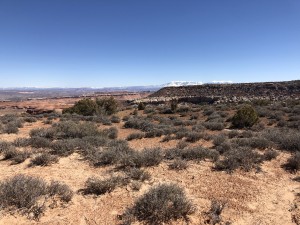
The best part about running Barlett Overlook, Hidden Canyon, and Hidden Canyon Overlook together is that you get to see the same scenery from all different angles. We had already been down in the canyon and we spent our lunch on the canyon's edge to the northwest. Now we'd see everything from the other side, on the south side of the canyon.

We ran up to the overlook fairly quickly and easily from where we came in at the end of the Hidden Canyon Overlook trail. This was probably the best scenery we'd had all day. We found rocks in the shade and just sat there taking it all in. We could see our trail through the canyon below us, and we spotted our lunch spot across the canyon on the far wall. We could even see the big, dirt hill on the Hidden Canyon Overlook trail.

We spotted a large, white structure that was probably at the intersection of highway 191 and I-70, so Roger got his binoculars. We weren't sure, but we think we could see the overpass that went over the highway. Very cool! We spotted a train stopped on the tracks there, too.

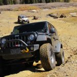
It was such a gorgeous day and no one really wanted to leave the overlook. But we had more to see before the sun went down so we headed out to the trailhead. We had a great time playing on the slab and rocks, and Ben saw more of what his new Jeep could do.

The race in the sand on the way out is a good time. There is good visibility so you can speed it up a notch, and the trail is smooth. When we got to the end we took a poll about what we'd see next. We decided to find a new trail, so we headed out on Dubinky Well Road to find Horsethief Point.

at_the_overlook
ben_down_the_rocks_part_1
ben_down_the_rocks_part_2
ben_down_the_rocks_part_3
ben_down_the_rocks_part_4
ben_down_the_rocks_part_5
ben_down_the_rocks_part_6
big_sky
bill_down_the_rocks_part_1
bill_down_the_rocks_part_2
bill_down_the_rocks_part_3
canyon_wash
desert_view
earlier_lunch_spot
hanging_out
hidden_canyon_overlook_trail
layers
overlook
rocks
roger_at_the_overlook
roger_down_the_rocks_part_1
roger_down_the_rocks_part_2
roger_down_the_rocks_part_3
roger_down_the_rocks_part_4
roger_down_the_rocks_part_5
sandy
see_for_miles
view_from_the_overlook
walt_down_the_rocks_part_1
walt_down_the_rocks_part_2
walt_down_the_rocks_part_3
walt_down_the_rocks_part_4
wispy_clouds

Reports from Other Days: 2

Use the arrows or dots to flip through the previews of the other reports for Bartlett Overlook. Click one of them to read more and see all of the photos from that day.

March 16, 2019

Led by Matt K.
The start of Bartlett Overlook was fun, and we tackled a very steep and narrow hill. The hill climb area was the hardest part of the trail, and we enjoyed it. We stopped at the overlook just for a few minutes and then finished the trail. The last half of…
»
  • 1
  • 2
Join Us!
If you aren’t a Member or Subscriber, you can’t see all of the content on this site. Get membership information to see why this site is best when you join and log in

Information for Subscribers

When you log in you’ll see more information here:

  • Recent Community Forum posts
  • Recent polls
  • Upcoming Events you can attend
  • Links to online users

© 2000-2021 · TrailDamage.com · Terms and Conditions · About · Contact
Trail information is only accurate on the date posted. Trails may have changed or closed since that date. Use this information for historical purposes only.
Contact the Forest Service or Bureau of Land Management for up-to-date trail information.

/* ----------------------------------------- */ /* View slug: reports-other-reports-for-same-trail-slider - start */ /* ----------------------------------------- */ /* place the prev/next controls on the sides */ .td-transition-controls .wpv-filter-next-link, .td-transition-controls .wpv-filter-previous-link { border: none; font-size: 300%; position: absolute; top: 70px; } .td-transition-controls .wpv-filter-previous-link { left: 0; } .td-transition-controls .wpv-filter-next-link { right: 0; } /* center the page selector horizonatally */ .td-transition-controls ul.wpv_pagination_dots { text-align: center; margin-top: 10px; } /* center the page selector horizonatally */ .td-transition-controls ul.wpv_pagination_dots li.wpv_pagination_dots_item, .td-transition-controls .wpv_pagination_dots li a { display: inline-block; float: none; } /* remove the default styles */ .td-transition-controls .wpv_pagination_dots li a { text-decoration: none; border-bottom: none; } .td-slider-container { padding: 0 25px; margin-bottom: 20px; position: relative; width:100%; display:table; } .td-slides { position: relative; } .td-slides-image { float:left; display:table-cell; } .td-slides-image img { border:1px solid #c0c0c0; } .td-slides-content { padding:4px 4px 4px 10px; border-top:1px solid #c0c0c0; border-right:1px solid #c0c0c0; border-bottom:1px solid #c0c0c0; display:table-cell; height:227px; overflow:hidden; } .td-slides-content h3 { margin-top:8px; } .td-slides-leader { font-size:smaller; margin-top:4px; } /* ----------------------------------------- */ /* View slug: reports-other-reports-for-same-trail-slider - end */ /* ----------------------------------------- */
/* ----------------------------------------- */ /* Content Template: Template for a Single Report - start */ /* ----------------------------------------- */ .entry-header { display:none; } .entry-content h1 { margin-top:16px; padding-top:0; } h1 a { color:#222; } h1 a:hover { color:#666; } p.entry-meta { font-size:small; } #report-body-spacer { clear:both; width:100%; height:20px; } #addtoany-bar { margin-bottom:2em; text-align:center; } .category-reports .post-info .author, .post-info .date { display: none; } .addthis_recommended_horizontal { text-align:center !important; } /* ----------------------------------------- */ /* Content Template: Template for a Single Report - end */ /* ----------------------------------------- */ /* ----------------------------------------- */ /* Content Template: Loop item in REPORTS Runners - start */ /* ----------------------------------------- */ #runners-container { width:100%; clear:both; } .runner { border:1px solid #c0c0c0; margin:0 6px 6px 0; float:left; width:49%; height:81px; } .runner-image { float: left; } .runner-image img { margin:2px 10px 0 2px; height:75px; width:75px; } .runner-name { text-transform:uppercase; } .runner-name a { color:#222; } .runner-name a:hover { color:#666; } .runner-vehicle { font-size:small; } @media only screen and (max-width: 768px) { .runner { width:100%; } } /* ----------------------------------------- */ /* Content Template: Loop item in REPORTS Runners - end */ /* ----------------------------------------- */