The trail information on this page is only available to Subscribers and Members who are logged in. If you have an account, use the "Log In" link found at the left side of this page in order to access this content. If you are not a Subscriber, you can use the subscription button to pay $12 for a year of access to everything on this website -- including this page.
Subscribe for Location and What to Expect

Maps and GPS Files
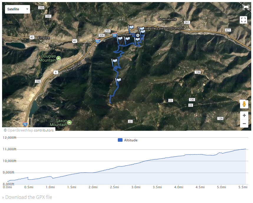
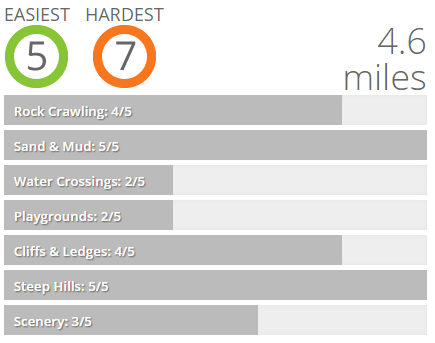
If there are any named obstacles, they're listed here. And if you have a GPS unit or a cell phone with GPS capabilities, download the GPX file to load it and take it with you. With a GPX file, you'll never be lost.
Detailed Trail Descriptions
We tell you what you'll see on the trail, turn by turn, in a story you'll be able to follow. If we like one of the spurs, we'll tell you about it and how to find it. If we thought there was a better place to turn around, we'll describe it. Sometimes, a map isn't enough to really understand a trail. We know how important it is to hear first hand about conditions, so we don't skimp when it comes to the descriptions of trails.
Planning Tools
Though it's not really trail information, we also include some tips about how to get to the trail from the nearest major town. We also tell you about at least one meeting place that is good for a group -- they usually feature a restroom, somewhere were you can buy provisions and gas, and an easy way to the trail.
Reports: 10
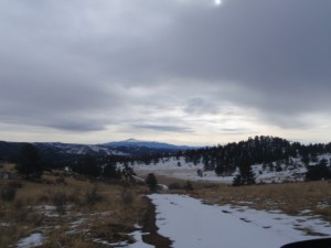
Use the arrows or dots to flip through the previews of the different reports for this trail. Click one of them to read more and see all of the photos from that day.