TrailDamage.com

Photos, videos and information about 4x4 trails in Colorado and Utah

  • Trails
    • Colorado
    • Utah
  • Reports
    • Featured Photos
    • Featured Videos
    • Reports Calendar
  • Members
  • Search
  • Trail Damage Winners
  • FAQ
  • Community
  • Upcoming Events
  • Membership
  • Log In
  • Facebook
  • Instagram
  • RSS
  • Twitter
  • YouTube

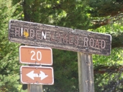
Hidden Lakes Road 120902

September 2, 2012 by Monica

Hidden Lakes Road

Trail Run on September 2, 2012
Report and photos by Monica I., Trail Leader
View trail information for Hidden Lakes Road

Monica I.
Red 2010 Jeep Wrangler Rubicon
Walt S.
Gray 2018 Jeep Wrangler Unlimited Rubicon
Mike S.
Silver 2004 Jeep Wrangler Rubicon
Roger R.
White 2005 Jeep Wrangler Unlimited Rubicon

We've always been big fans of exploring, so we like to check out trails we haven't seen before. We finished a great time on Sawmill Creek and we were planning on using Hidden Lakes Road to make a big loop back up to Buffalo Pass. But first we were going to see how far Hidden Lakes Road went to the south. How close would we get to Rabbit Ears Peak? We were going to find out.

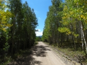
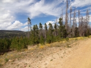
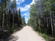
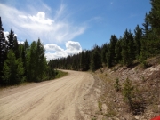
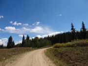
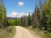
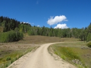
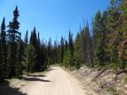
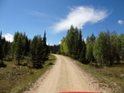
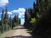
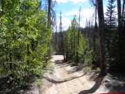
After the bumpy fun climbing up and down the Sawmill Creek trail, Hidden Lakes Road was a huge contrast. The road was smooth, wide in most spots, and very well maintained. It wove through the trees and most of the time there were no views. It was kind of mellow and a bit boring but it must go somewhere, right?

Wrong -- it just ended. In fact, someone was using the end of the trail as a campsite. So we basically turned around right next to someone's tent. It was a little odd. We found a couple vehicles parked next to a gated spur and we assumed they were hiking. It could get them closer to Rabbit Ears Peak but there was no marked hiking trail. It was a better spot to turn around, though, so we'd use that next time instead of the dead end.

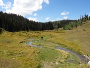
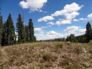
We turned around and headed back, stopping once at a drained lake that used to be Bear Park Reservoir. It was weird seeing cows grazing in the old reservoir. Still, it made for a scenic and soggy valley.

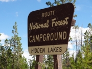
We continued north and saw on the topo maps that the Hidden Lakes were just off of the road. We couldn't see them from the road, though. We skipped going into the campground, opting to take the spur to Stambaugh Reservoir instead. It was a good choice.

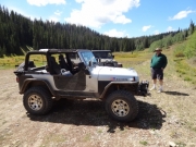
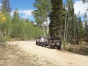
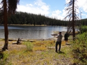
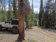
The little spur to the reservoir was much rougher than the main trail, but it added some fun. There were a lot of cars parked next to the reservoir so we parked in a campsite farther up from the water next to a car filled with barking dogs, and then we walked down to the water. It was really nice, and we enjoyed the scenery. It was out in the hot sun, though, and even though it was lunch time we decided to go back up next to the Jeeps and eat in the shade.

It was a really nice lunch, even though we were surrounded by people. The last trail meal of a wheeling trip is always a nice one.

We enjoyed the break from driving but we eventually headed back up to the trail. We noted how many spurs were gated, and it was a bummer. Once we got up to Buffalo Pass we turned right and headed out. That was a really great loop!

aspens_turning
break_time
colorado_creek
different_trees
drained_reservoir
easy_trail
from_sawmill_creek
gentle_curve
greens
hidden_lakes_campground
little_grizzly_creek_sign
meadow
mellow_trail
mountain_scenery
narrowest_section
parked_at_the_trailhead
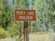
percy_lake_trailhead
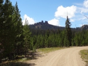
rabbit_ears_peak_part_1
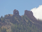
rabbit_ears_peak_part_2
shaded
sign_at_sawmill_creek_intersection
sign_to_stambaugh_reservoir
stambaugh_reservoir_part_1
stambaugh_reservoir_part_2
stambaugh_reservoir_part_3
to_stambaugh_reservoir
trailhead_sign
yellow_aspens
Join Us!
If you aren’t a Member or Subscriber, you can’t see all of the content on this site. Get membership information to see why this site is best when you join and log in

Information for Subscribers

When you log in you’ll see more information here:

  • Recent Community Forum posts
  • Recent polls
  • Upcoming Events you can attend
  • Links to online users

© 2000-2021 · TrailDamage.com · Terms and Conditions · About · Contact
Trail information is only accurate on the date posted. Trails may have changed or closed since that date. Use this information for historical purposes only.
Contact the Forest Service or Bureau of Land Management for up-to-date trail information.

/* ----------------------------------------- */ /* View slug: reports-other-reports-for-same-trail-slider - start */ /* ----------------------------------------- */ /* place the prev/next controls on the sides */ .td-transition-controls .wpv-filter-next-link, .td-transition-controls .wpv-filter-previous-link { border: none; font-size: 300%; position: absolute; top: 70px; } .td-transition-controls .wpv-filter-previous-link { left: 0; } .td-transition-controls .wpv-filter-next-link { right: 0; } /* center the page selector horizonatally */ .td-transition-controls ul.wpv_pagination_dots { text-align: center; margin-top: 10px; } /* center the page selector horizonatally */ .td-transition-controls ul.wpv_pagination_dots li.wpv_pagination_dots_item, .td-transition-controls .wpv_pagination_dots li a { display: inline-block; float: none; } /* remove the default styles */ .td-transition-controls .wpv_pagination_dots li a { text-decoration: none; border-bottom: none; } .td-slider-container { padding: 0 25px; margin-bottom: 20px; position: relative; width:100%; display:table; } .td-slides { position: relative; } .td-slides-image { float:left; display:table-cell; } .td-slides-image img { border:1px solid #c0c0c0; } .td-slides-content { padding:4px 4px 4px 10px; border-top:1px solid #c0c0c0; border-right:1px solid #c0c0c0; border-bottom:1px solid #c0c0c0; display:table-cell; height:227px; overflow:hidden; } .td-slides-content h3 { margin-top:8px; } .td-slides-leader { font-size:smaller; margin-top:4px; } /* ----------------------------------------- */ /* View slug: reports-other-reports-for-same-trail-slider - end */ /* ----------------------------------------- */
/* ----------------------------------------- */ /* Content Template: Template for a Single Report - start */ /* ----------------------------------------- */ .entry-header { display:none; } .entry-content h1 { margin-top:16px; padding-top:0; } h1 a { color:#222; } h1 a:hover { color:#666; } p.entry-meta { font-size:small; } #report-body-spacer { clear:both; width:100%; height:20px; } #addtoany-bar { margin-bottom:2em; text-align:center; } .category-reports .post-info .author, .post-info .date { display: none; } .addthis_recommended_horizontal { text-align:center !important; } /* ----------------------------------------- */ /* Content Template: Template for a Single Report - end */ /* ----------------------------------------- */ /* ----------------------------------------- */ /* Content Template: Loop item in REPORTS Runners - start */ /* ----------------------------------------- */ #runners-container { width:100%; clear:both; } .runner { border:1px solid #c0c0c0; margin:0 6px 6px 0; float:left; width:49%; height:81px; } .runner-image { float: left; } .runner-image img { margin:2px 10px 0 2px; height:75px; width:75px; } .runner-name { text-transform:uppercase; } .runner-name a { color:#222; } .runner-name a:hover { color:#666; } .runner-vehicle { font-size:small; } @media only screen and (max-width: 768px) { .runner { width:100%; } } /* ----------------------------------------- */ /* Content Template: Loop item in REPORTS Runners - end */ /* ----------------------------------------- */