The trail information on this page is only available to Subscribers and Members who are logged in. If you have an account, use the "Log In" link found at the left side of this page in order to access this content. If you are not a Subscriber, you can use the subscription button to pay $12 for a year of access to everything on this website -- including this page.
Subscribe for Location and What to Expect
Trail pages are one of the biggest features for Subscribers. There are hundreds of trails in Colorado and Utah featured here, and the list keeps growing. If you were logged in, you'd see the states and counties the trail was located in right at the top. If it is part of a National Forest, you'd see the list of forests the trail crosses as well as the forest service road numbers. The same thing happens for BLM land and other recreational areas. County road numbers are also shown, if they apply. We even provide a link to the up-to-date trail conditions on BushDucks.com, if they work with the trail.
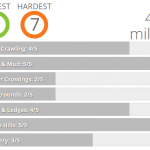
Most people come for the trail ratings and a snapshot of what to expect on the trail. Ratings span from 1 as the easiest (a dirt road fine for a passenger car) to 10 as the hardest (4x4 buggies only). TrailDamage.com gives you two ratings -- one for the easiest possible route through the trail and another for the hardest possible route. In many cases, these numbers are the same. But for some trails, the numbers are vastly different when there are lots of options.
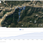
If you are hiking the trail, elevation gain is important to know. Each trail features a small graph showing the range of elevations. This is handy even for people in vehicles, because it gives you a good idea what the weather will be like and if you might see snow.
Maps and GPS Files
Trail information wouldn't be complete without a map of the area, and we use Google Maps to make things easy. Blow it up to a full-sized map, scroll around, see satellite information as well as roads and trails, and use Google to map directions from where you are to the trailhead. Elevation profiles show if the trail goes up and down, heads straight uphill, or if it's fairly flat. This information is great for hikers.
If there are any named obstacles, they're listed here. And if you have a GPS unit or a cell phone with GPS capabilities, download the GPX file to load it and take it with you. With a GPX file, you'll never be lost.
Detailed Trail Descriptions
We tell you what you'll see on the trail, turn by turn, in a story you'll be able to follow. If we like one of the spurs, we'll tell you about it and how to find it. If we thought there was a better place to turn around, we'll describe it. Sometimes, a map isn't enough to really understand a trail. We know how important it is to hear first hand about conditions, so we don't skimp when it comes to the descriptions of trails.
Planning Tools
Though it's not really trail information, we also include some tips about how to get to the trail from the nearest major town. We also tell you about at least one meeting place that is good for a group -- they usually feature a restroom, somewhere were you can buy provisions and gas, and an easy way to the trail.
Find the videos we've posted about the trail all gathered in once place, and a list of nearby trails. Use the drop-down menu to expand your search and plan your day.
Reports: 19
Use the arrows or dots to flip through the previews of the different reports for this trail. Click one of them to read more and see all of the photos from that day.