TrailDamage.com

Photos, videos and information about 4x4 trails in Colorado and Utah

  • Trails
    • Colorado
    • Utah
  • Reports
    • Featured Photos
    • Featured Videos
    • Reports Calendar
  • Members
  • Search
  • Trail Damage Winners
  • FAQ
  • Community
  • Upcoming Events
  • Membership
  • Log In
  • Facebook
  • Instagram
  • RSS
  • Twitter
  • YouTube

Stillwater Pass 100724

July 24, 2010 by Monica

Stillwater Pass

Trail Run on July 24, 2010
Report and photos by Monica I., Trail Leader
View trail information for Stillwater Pass

Roger R.
Gray 2021 Jeep Wrangler Rubicon 4xe
Monica I.
Red 2010 Jeep Wrangler Rubicon
Walt S.
Gray 2022 Jeep Wrangler Unlimited Rubicon 392

Stillwater Pass had always been near the top of our To Do List. It wasn't supposed to be particularly challenging or beautiful, but it was one of the Colorado staples. We were glad to finally be on it.

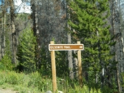
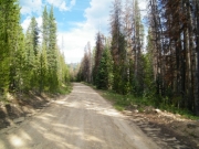
Most of our group did the very beginning of the trail to get to Camway Trail. After we did that trail a good portion of the group left for home while three of us continued on. It was getting late, but we should finish everything in daylight.

We weaved our way along the trail after Camway Trail, and when we got to the Gravel Mountain sign we did that trail, too. We were hoping for something adventurous (after all, it was marked as a "4x4" trail) but it wasn't much after doing North Supply Creek. There was a fun section there but it was brief.

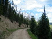
Walt and Roger waited at the north end of the Gravel Mountain trail while Monica mapped and checked out the section of Stillwater Pass that we missed. That part contained a brief shelf road, but it wasn't a big deal.

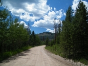
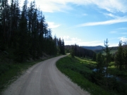
Stillwater Pass was never very difficult. In fact, we were talking on the CB about how we were heading downhill but no one noticed a pass or anything marking the pass. It turned out that the pass was right after we finished the Gravel Mountain trail.

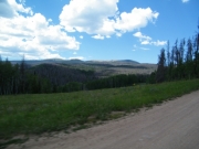
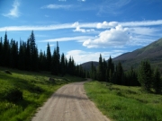
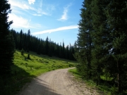
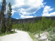
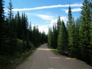
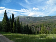
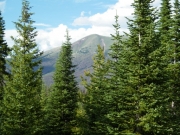
The descent was the most scenic section. We could see the Blue Ridge in the distance, through the trees.

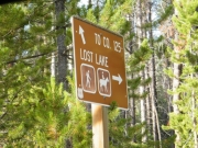
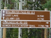
We were hoping to see Lost Lake, but it was a hiking trail. It was a short hiking trail, but we were running out of daylight. We'll definitely check it out the next time we are on this trail. We ended up turning around and heading back to Stillwater Pass.

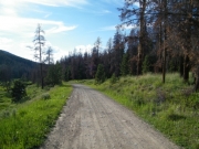
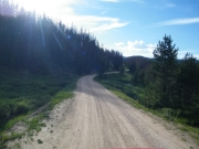
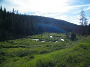
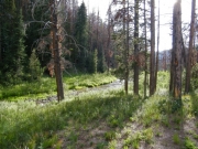
Dusk couldn't have been prettier as we followed the creek. It made everything very green and marshy. There also wasn't much beetle kill on this side, which was nice. The breeze was nice as the sun went down, and everyone seemed very content.

We hit the pavement before we were expecting it, so we had to drive a bit on the asphalt until we found a wide spot where we could pull off and air back up. Monica had plans to eat dinner in Granby on the way out, so she left earlier than Walt and Roger.

On the way back to Granby, Monica spotted Matt P. camping near the road. She pulled off to visit. Then she saw Walt followed by Roger up on the highway. She waved them down. Walt slowed down, put on his turn signal, and prepared to turn. But Roger was on autopilot and left some rubber on the road as he slammed on his brakes and barely missed hitting Walt. It made for some interesting conversation!

The sun still wasn't down and we completed a lot in one day. It felt like we really saw a lot of different areas, and it made everyone happy. We picked the right area because it snowed that day on Boreas Pass and all we had was sunshine. It was a great day!

big_view
bumpy
colorful
curve_ahead
dusk
early_trail
gilsonite_trail
heading_downhill
healthy_trees
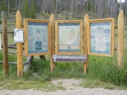
kiosk_near_trailhead
lost_lake_hiking
lost_lake_sign
marshy
mellow
open_space
porphyry_peaks
rolling_hill
shelf_road
slope
spur
sun_going_down
to_lost_lake
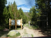
trailhead_sign
willow_creek
Join Us!
If you aren’t a Member or Subscriber, you can’t see all of the content on this site. Get membership information to see why this site is best when you join and log in

Information for Subscribers

When you log in you’ll see more information here:

  • Recent Community Forum posts
  • Recent polls
  • Upcoming Events you can attend
  • Links to online users

© 2000-2023 · TrailDamage.com · Terms and Conditions · About · Contact
Trail information is only accurate on the date posted. Trails may have changed or closed since that date. Use this information for historical purposes only.
Contact the Forest Service or Bureau of Land Management for up-to-date trail information.

/* ----------------------------------------- */ /* View slug: reports-other-reports-for-same-trail-slider - start */ /* ----------------------------------------- */ /* place the prev/next controls on the sides */ .td-transition-controls .wpv-filter-next-link, .td-transition-controls .wpv-filter-previous-link { border: none; font-size: 300%; position: absolute; top: 70px; } .td-transition-controls .wpv-filter-previous-link { left: 0; } .td-transition-controls .wpv-filter-next-link { right: 0; } /* center the page selector horizonatally */ .td-transition-controls ul.wpv_pagination_dots { text-align: center; margin-top: 10px; } /* center the page selector horizonatally */ .td-transition-controls ul.wpv_pagination_dots li.wpv_pagination_dots_item, .td-transition-controls .wpv_pagination_dots li a { display: inline-block; float: none; } /* remove the default styles */ .td-transition-controls .wpv_pagination_dots li a { text-decoration: none; border-bottom: none; } .td-slider-container { padding: 0 25px; margin-bottom: 20px; position: relative; width:100%; display:table; } .td-slides { position: relative; } .td-slides-image { float:left; display:table-cell; } .td-slides-image img { border:1px solid #c0c0c0; } .td-slides-content { padding:4px 4px 4px 10px; border-top:1px solid #c0c0c0; border-right:1px solid #c0c0c0; border-bottom:1px solid #c0c0c0; display:table-cell; height:227px; overflow:hidden; } .td-slides-content h3 { margin-top:8px; } .td-slides-leader { font-size:smaller; margin-top:4px; } /* ----------------------------------------- */ /* View slug: reports-other-reports-for-same-trail-slider - end */ /* ----------------------------------------- */
/* ----------------------------------------- */ /* Content Template: Template for a Single Report - start */ /* ----------------------------------------- */ .entry-header { display:none; } .entry-content h1 { margin-top:16px; padding-top:0; } h1 a { color:#222; } h1 a:hover { color:#666; } p.entry-meta { font-size:small; } #report-body-spacer { clear:both; width:100%; height:20px; } #addtoany-bar { margin-bottom:2em; text-align:center; } .category-reports .post-info .author, .post-info .date { display: none; } .addthis_recommended_horizontal { text-align:center !important; } /* ----------------------------------------- */ /* Content Template: Template for a Single Report - end */ /* ----------------------------------------- */ /* ----------------------------------------- */ /* Content Template: Loop item in REPORTS Runners - start */ /* ----------------------------------------- */ #runners-container { width:100%; clear:both; } .runner { border:1px solid #c0c0c0; margin:0 6px 6px 0; float:left; width:49%; height:81px; } .runner-image { float: left; } .runner-image img { margin:2px 10px 0 2px; height:75px; width:75px; } .runner-name { text-transform:uppercase; } .runner-name a { color:#222; } .runner-name a:hover { color:#666; } .runner-vehicle { font-size:small; } @media only screen and (max-width: 768px) { .runner { width:100%; } } /* ----------------------------------------- */ /* Content Template: Loop item in REPORTS Runners - end */ /* ----------------------------------------- */