Poison Springs Canyon
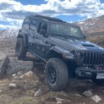
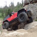
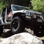
We really didn't know what to expect from Poison Springs Canyon. We practically got run off the road when trying to turn off of the pavement, and then we stopped to air down and read some signs. It was already a little after 11AM and we were just getting started. The signs made it seem like this wasn't going to take long, anyway.
We knew we'd be crossing the Dirty Devil River at some point, and we weren't sure if it would be too deep to cross. There had been a lot of rain lately, and it might turn us back. Then we saw a sign on a kiosk that said the road was "washed out in Hatch Canyon approximately 4 miles past the Dirty Devil River Ford." That wasn't a good sign. Still, we wanted to see the river crossing and the trail itself, so we decided to press on and check things out.
The trip in the canyon was pretty cool. It was secluded and nice, and the cloud cover made the temperatures reasonable. After two days of roasting in the heat, this was a welcome change. The farther we went, the more puddles we saw along the trail. One of them was pretty deep and wide.
We found the river crossing and realized it was noon, so we parked and set up lunch. We were hoping to see someone else go through the water, but we had the place to ourselves. It was a very scenic place for lunch in the soft sand, and we took our time.
The river crossing wasn't difficult at all. The only challenge was the small hill on the other side to get out of the water. We had fun crossing and reset our odometers, and then headed up a hill.
We found ourselves on a fairly long stretch of shelf road. It seemed longer as we were looking for the washed out section of trail around every turn. We expected it at around four miles after the water, but four miles came and went. The shelf road even ended and we hadn't seen the wash out yet. We were starting to think they fixed it but didn't update the sign, or it was such a small wash out that we didn't notice it. Either way, we wanted to keep going.
At 8.7 miles past the river crossing, we stopped because we'd finally found the wash out. It was huge, and there was no fixing the trail. We walked around, and at first we didn't even see the way around it. We were bummed, because we thought we were going to have to turn back.
Then, Frank found the bypass. The start of it was back a little distance from where we stopped. It dipped down into the ravine along a wide and easy hill, ran along the ravine for a short distance, and then went up a crack on the other side. It was established and it looked like fun. Fantastic! In fact, Bypastastic! It already had a name.
Monica went through first, and found that she needed four-wheel drive to get up the other side, and lockers made it even better. There was a turn at the bottom before heading uphill, making some tires a bit lighter than others at that turn. Lockers just made that easier. At the top, she did a three-point turn to get back to the main trail. Success!
Frank was having issues with his lockers, and they weren't helping him in the ravine. He had to adjust his line a couple times, and then gave it some momentum to get up the hill. Then Walt came through, making the whole thing look easy. We were all through to the other side, and the obstacle was a great time and wonderful surprise.
The wash out seemed to be at an area where drainage pipes had been installed, and then the dirt eroded away. It looked like there was good maintenance at one time, but that time was over.
After the wash out, the trail was different. It was a bit less maintained, and it wasn't as curvy. There were sections that were actually straight. We found a couple sections with drainage pipes again, and they were on their way to being wash outs. It's very possible that this trail will be truly impassible one day in the near future. At this point, though, we could make it all the way through.
We knew we wouldn't have time to see everything in the area, so we drove by the South Hatch Canyon trail. We stopped at the hiking trail that goes up and on top of The Big Ridge to take a break. Though the trail was remote, we kept seeing big cairns and remnants of old cabins. It felt like the area saw more people than you would think, though we didn't see anyone.
There are two hill climbs, and both of them are fun. The first one went up to a saddle where we got out to snap some pictures. It was really windy, though, so we didn't stay long. The sun was out, and skies were finally blue.
The second hill climb is past the park boundary, taking us up to Sunset Pass and yet another trail we didn't have time for. After that, the trail headed almost straight as we worked our way down to the big four-way intersection we saw the day before.
It was too late in the day to check out the Land of Standing Rocks and the Dollhouse, and we were bummed. However, it wasn't too late to see Flint Trail, Gordon Flats, and Hans Flat Road in the daylight. So, we turned left on Lands End to go check things out.


