TrailDamage.com

Photos, videos and information about 4x4 trails in Colorado and Utah

  • Trails
    • Colorado
    • Utah
  • Reports
    • Featured Photos
    • Featured Videos
    • Reports Calendar
  • Members
  • Search
  • Trail Damage Winners
  • FAQ
  • Community
  • Upcoming Events
  • Membership
  • Log In
  • Facebook
  • Instagram
  • RSS
  • Twitter
  • YouTube

Burch Canyon 101020

October 20, 2010 by Monica

Burch Canyon

Trail Run on October 20, 2010
Report and photos by Monica I., Trail Leader
View trail information for Burch Canyon

Walt S.
Gray 2018 Jeep Wrangler Unlimited Rubicon
Monica I.
Red 2010 Jeep Wrangler Rubicon

We knew by looking at the topo maps that this trail was going to be interesting at its far end. It looked like it went almost straight down a cliff. We were happy to find that it was a maintained trail, though it wasn't nearly as maintained as the trails we had been on up to that point.

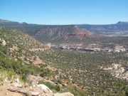
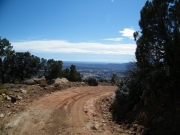
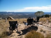
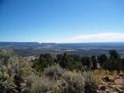
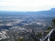
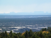
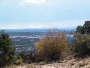
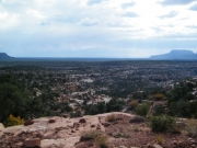
We had done the middle section of Woodenshoe Buttes and we started down the far end of Burch Canyon at the west end. We soon came to a pull out and it was about lunch time, so we stopped there. It was a short walk with all of our gear to get to the edge of the cliff, and the views were absolutely amazing. We had been to the Natural Bridges National Monument earlier in the day, and we could see the paved road running through it as well as cars in parking areas. We could see where the bridges would be, but our angle made viewing them impossible. Walt broke out the binoculars and we stood around gawking for awhile after lunch was finished.

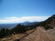
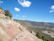
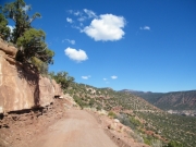
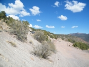
We could see our trail continuing below us, so we headed out. It was a pretty steep descent, though it never felt dangerous. Of course, it was dry dirt. If it had been wet it probably would have been impossible.

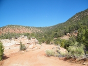
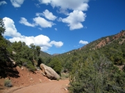
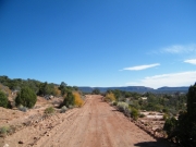
It seemed like a long distance before we finally ended up in the canyon below us. At that point, the trail was pretty mellow. We weaved through the brush and even tried what looked like it might be an overlook, but that was a bust.

When we got to the turn that looked like it would take us back up to Woodenshoe Buttes, we took it slowly and carefully. It was rocky, loose and eroded. It was definitely not maintained. We didn't go far before we got out to walk it a little way, only to find out that it was probably too eroded for us to continue. It became known as the "crazy trail" from then on. We decided that a dirt bike might be okay on that crazy trail, but even an ATV could get into trouble. We carefully backed out, turned around, and went back to the main trail.

We followed our maps until where we thought the trail ended, intending to turn around and go back to the trailhead. But the trail kept going, so we followed it. It met back up with the highway, so our plan was a bit messed up. Still, we found a new way to and from Woodenshoe Buttes so it all worked out.

It was really good to see the area from a different perspective, and we really enjoyed how remote it was in Burch Canyon.

burch_canyon
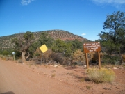
carsonite_sign
curve
descent
down_switchbacks_part_1
down_switchbacks_part_2
down_switchbacks_part_3
down_switchbacks_part_4
dusty
lunch
mellow
natural_bridges_national_monument_part_1
natural_bridges_national_monument_part_2
natural_bridges_national_monument_part_3
natural_bridges_national_monument_part_4
natural_bridges_national_monument_part_5
natural_bridges_national_monument_part_6
natural_bridges_national_monument_part_7
natural_bridges_national_monument_part_8
walt_on_the_trail
warning_sign
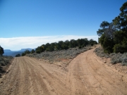
west_end
Join Us!
If you aren’t a Member or Subscriber, you can’t see all of the content on this site. Get membership information to see why this site is best when you join and log in

Information for Subscribers

When you log in you’ll see more information here:

  • Recent Community Forum posts
  • Recent polls
  • Upcoming Events you can attend
  • Links to online users

© 2000-2021 · TrailDamage.com · Terms and Conditions · About · Contact
Trail information is only accurate on the date posted. Trails may have changed or closed since that date. Use this information for historical purposes only.
Contact the Forest Service or Bureau of Land Management for up-to-date trail information.

/* ----------------------------------------- */ /* View slug: reports-other-reports-for-same-trail-slider - start */ /* ----------------------------------------- */ /* place the prev/next controls on the sides */ .td-transition-controls .wpv-filter-next-link, .td-transition-controls .wpv-filter-previous-link { border: none; font-size: 300%; position: absolute; top: 70px; } .td-transition-controls .wpv-filter-previous-link { left: 0; } .td-transition-controls .wpv-filter-next-link { right: 0; } /* center the page selector horizonatally */ .td-transition-controls ul.wpv_pagination_dots { text-align: center; margin-top: 10px; } /* center the page selector horizonatally */ .td-transition-controls ul.wpv_pagination_dots li.wpv_pagination_dots_item, .td-transition-controls .wpv_pagination_dots li a { display: inline-block; float: none; } /* remove the default styles */ .td-transition-controls .wpv_pagination_dots li a { text-decoration: none; border-bottom: none; } .td-slider-container { padding: 0 25px; margin-bottom: 20px; position: relative; width:100%; display:table; } .td-slides { position: relative; } .td-slides-image { float:left; display:table-cell; } .td-slides-image img { border:1px solid #c0c0c0; } .td-slides-content { padding:4px 4px 4px 10px; border-top:1px solid #c0c0c0; border-right:1px solid #c0c0c0; border-bottom:1px solid #c0c0c0; display:table-cell; height:227px; overflow:hidden; } .td-slides-content h3 { margin-top:8px; } .td-slides-leader { font-size:smaller; margin-top:4px; } /* ----------------------------------------- */ /* View slug: reports-other-reports-for-same-trail-slider - end */ /* ----------------------------------------- */
/* ----------------------------------------- */ /* Content Template: Template for a Single Report - start */ /* ----------------------------------------- */ .entry-header { display:none; } .entry-content h1 { margin-top:16px; padding-top:0; } h1 a { color:#222; } h1 a:hover { color:#666; } p.entry-meta { font-size:small; } #report-body-spacer { clear:both; width:100%; height:20px; } #addtoany-bar { margin-bottom:2em; text-align:center; } .category-reports .post-info .author, .post-info .date { display: none; } .addthis_recommended_horizontal { text-align:center !important; } /* ----------------------------------------- */ /* Content Template: Template for a Single Report - end */ /* ----------------------------------------- */ /* ----------------------------------------- */ /* Content Template: Loop item in REPORTS Runners - start */ /* ----------------------------------------- */ #runners-container { width:100%; clear:both; } .runner { border:1px solid #c0c0c0; margin:0 6px 6px 0; float:left; width:49%; height:81px; } .runner-image { float: left; } .runner-image img { margin:2px 10px 0 2px; height:75px; width:75px; } .runner-name { text-transform:uppercase; } .runner-name a { color:#222; } .runner-name a:hover { color:#666; } .runner-vehicle { font-size:small; } @media only screen and (max-width: 768px) { .runner { width:100%; } } /* ----------------------------------------- */ /* Content Template: Loop item in REPORTS Runners - end */ /* ----------------------------------------- */